Project Background
Recently Alain Outlaw, Principal Archaeologist with Archaeological and Cultural Solutions Inc. (ACS), contacted St. John’s Church and requested to perform further research and exploration of our second church site. Alain was a junior member of the archaeological team that studied the second site almost fifty years ago. Alain has spent a great amount of time researching the existing written records of Hampton’s colonial past. Based on this research Alain considers it is possible that the location of our first church may be on, or in the vicinity of, our second church site. The Vestry requested Alain provide a plan of action with a duration and cost estimate to perform the research and exploration. Alain’s plan of action proposed to perform the exploratory work during the months of April through June, starting this year and continuing through 2024. While the cost for this project is significant, the potential upside is also significant. Mary Williams Trust offered to cover the cost of the entire project. That cost is being administered through the Cemetery Fund.
With the above information in hand, the Vestry with the Church Trustees developed a “Memorandum of Understanding” that set the rules and responsibilities for all parties involved and serves as our legal documentation if a problem occurs during the project. Upon completion of the above, the Vestry nominated Charlie Edmonson to be the church’s direct contact with ACS for the duration of the project.
Project Update
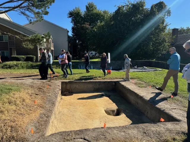
Since excavations formally began on June 6, Archaeological & Cultural Solutions, Inc. (ACS) has concentrated on two locations to explore and research the nature of the site in more detail than was done in the distant past, to better understand what took place at this important place. One lies off the southeast corner of the cobblestone church foundation, where a recent brief ground penetrating radar study suggested the presence of a line of structural post holes roughly parallel to the church foundation. At present superimposed later grave shafts, which are carefully being avoided, obscure the subsurface; however, other cultural features seem to be in the vicinity, perhaps evidence of an earlier church or an indication of domestic or military activity.
A second area was opened straddling the north church wall to examine and properly record a grave shaft that was said to be on a north/south axis rather than in the normal Christian east/west orientation. Records of the late-1960s/early-1970s indicate the grave by an “X”. Recording the grave outline, orientation, and relationship to the foundation is important, as it could predate the church and also be associated with domestic or military use of the property. Thus far, the artifact date range spans the prehistoric period to as late as 1968 (Washington quarter). Significantly, since backfill soils from the 1910 and 1960s/1970s investigations were inconsistently screened, these finds include the principal period of interest—the first quarter of the seventeenth century.
Originally published in St. John’s Newsletter, September 2022.